Category:Miles Platting
Jump to navigation
Jump to search
inner city district of Manchester, England | |||||
| Upload media | |||||
| Instance of | |||||
|---|---|---|---|---|---|
| Location | Manchester, Greater Manchester, North West England, England | ||||
 | |||||
English: Miles Platting is situated in the Manchester City Council ward of Miles Platting and Newton Heath in the City of Manchester
Subcategories
This category has the following 5 subcategories, out of 5 total.
D
M
- Miles Platting Junction (2 F)
P
- Philips Park Cemetery (5 F)
V
- Victoria Mills, Miles Platting (26 F)
Media in category "Miles Platting"
The following 63 files are in this category, out of 63 total.
-
 A cleared site in Miles Platting - geograph.org.uk - 1919361.jpg 3,872 × 2,494; 3.7 MB
-
 A derelict building on Bradford Road - geograph.org.uk - 3640226.jpg 800 × 600; 141 KB
-
 A former church on Every Street - geograph.org.uk - 3640145.jpg 800 × 600; 163 KB
-
 Ancoats Butler Lane Bridge- 4567.JPG 3,488 × 2,616; 2.2 MB
-
 Ancoats Butler Lane Bridge- 4570.JPG 3,488 × 2,616; 2.18 MB
-
 Ashton Canal, Ancoats - geograph.org.uk - 3640222.jpg 800 × 600; 157 KB
-
 Back of the Shops - Hulme Hall Lane - geograph.org.uk - 2329117.jpg 1,152 × 864; 462 KB
-

-
 Beautiful concrete jungle in Miles Platting, Manchester - panoramio.jpg 3,072 × 2,304; 1.83 MB
-
 Beer Festival Here - geograph.org.uk - 2242565.jpg 2,592 × 1,944; 2.83 MB
-
 Birmingham RC&W Co E51831 E59695 E51811.jpg 3,900 × 2,600; 6.22 MB
-
 Bluebird (Middleton) bus, 20 September 2007.jpg 2,048 × 1,536; 316 KB
-
 Broadhaven Road - geograph.org.uk - 5371727.jpg 5,184 × 3,126; 1.66 MB
-

-
 Coleshill Street - geograph.org.uk - 5553188.jpg 5,001 × 3,334; 1.76 MB
-
 Coleshill Street - geograph.org.uk - 5845333.jpg 4,032 × 3,024; 2.05 MB
-
 First class and second class at Miles Platting - geograph.org.uk - 3982813.jpg 1,024 × 768; 147 KB
-

-
 Houses in Holland Street, Miles Platting - geograph.org.uk - 3983047.jpg 1,024 × 768; 146 KB
-
 Livesey Street near Bothwell Road - geograph.org.uk - 2585143.jpg 800 × 600; 255 KB
-
 M for Manchester - geograph.org.uk - 1185220.jpg 640 × 480; 149 KB
-

-
 Medway Walk - geograph.org.uk - 4625897.jpg 5,184 × 2,708; 1.94 MB
-
 Miles Platting - geograph.org.uk - 5553192.jpg 5,173 × 2,790; 1.97 MB
-
 Miles Platting - geograph.org.uk - 5845334.jpg 4,032 × 2,546; 2 MB
-
 Miles Platting - geograph.org.uk - 5845338.jpg 3,994 × 2,382; 1.99 MB
-
 Miles Platting - geograph.org.uk - 5845342.jpg 4,031 × 2,825; 1.87 MB
-
 Miles Platting - Oldham Road - geograph.org.uk - 1185222.jpg 640 × 480; 183 KB
-
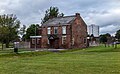
 Miles Platting Bank, Manchester - geograph.org.uk - 3152731.jpg 640 × 480; 93 KB
-

-
 Miles Platting junction - geograph.org.uk - 1009598.jpg 640 × 460; 61 KB
-
 New housing on old streets - geograph.org.uk - 3231989.jpg 640 × 482; 94 KB
-
 Oldham Road - geograph.org.uk - 4291999.jpg 3,365 × 1,789; 1.41 MB
-
 Oldham Road - geograph.org.uk - 4292004.jpg 3,865 × 2,142; 1.87 MB
-
 Oldham Road at Queens Road junction, Miles Platting - geograph.org.uk - 3312400.jpg 2,048 × 1,152; 742 KB
-
 Oldham Road, Miles Platting - panoramio.jpg 4,000 × 3,000; 4.86 MB
-
 Park improvements, Miles Platting - geograph.org.uk - 3983029.jpg 1,024 × 768; 136 KB
-

-
 Queens Road meets Oldham Road, Miles Platting - geograph.org.uk - 3312399.jpg 2,048 × 1,152; 757 KB
-
 Rochdale Canal at Miles Platting - geograph.org.uk - 3149529.jpg 2,048 × 1,536; 596 KB
-
 Rochdale Canal at Miles Platting - geograph.org.uk - 3982991.jpg 1,024 × 768; 116 KB
-
 Rubbish in the cut at Miles Platting - geograph.org.uk - 3982815.jpg 1,024 × 768; 110 KB
-
 Rubbish on the Rochdale Canal, Miles Platting - geograph.org.uk - 3983007.jpg 1,024 × 768; 123 KB
-
 St Anne's Church on Carruthers Street - geograph.org.uk - 3640177.jpg 800 × 600; 118 KB
-
 St Patrick's Church, Miles Platting.jpg 5,184 × 3,888; 5.78 MB
-
 The Apollo - geograph.org.uk - 4292002.jpg 3,601 × 1,911; 1.65 MB
-
 The Apollo - geograph.org.uk - 5553185.jpg 5,183 × 2,785; 1.96 MB
-
 The Apollo, Miles Platting - geograph.org.uk - 3633905.jpg 800 × 600; 157 KB
-
 The Apollo, Miles Platting - geograph.org.uk - 3633908.jpg 600 × 800; 162 KB
-
 The Bank of England on Carruthers Street - geograph.org.uk - 3640203.jpg 800 × 600; 144 KB
-
 The Bank of England on Carruthers Street - geograph.org.uk - 3640210.jpg 600 × 800; 166 KB
-
 The Fountain of Life Christian Centre - geograph.org.uk - 1919387.jpg 3,653 × 2,471; 2.6 MB
-
 The Kippax - geograph.org.uk - 4625912.jpg 5,183 × 2,775; 1.65 MB
-
 The Navigation - geograph.org.uk - 5064504.jpg 4,046 × 2,488; 1.68 MB
-
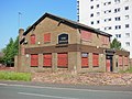
 The Navigation public house - geograph.org.uk - 2611596.jpg 800 × 600; 220 KB
-

-

-

-
 Victoria Mill Park, Miles Platting - geograph.org.uk - 3155950.jpg 640 × 481; 550 KB
-
 Victoria Mill, Miles Platting - geograph.org.uk - 3155970.jpg 480 × 640; 644 KB
-
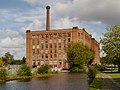 Victoria Mill, Miles Platting - geograph.org.uk - 3156131.jpg 640 × 481; 519 KB
-
 We're not scared^ - geograph.org.uk - 2242561.jpg 2,592 × 1,944; 1.64 MB
-
 Woodwad Court, Miles Platting - panoramio.jpg 720 × 960; 201 KB


_bus,_20_September_2007.jpg)


